An attempt to remap Europe and claim back the lost territories of the North Sea
- [intlink id="41" type="post"]More about this project[/intlink]
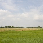
During one of the warmer weekends in early August, we took a day trip to the peninsula of Butjadingen, between the Jade and Weser estuaries. I’d been interested to go there for some time, as I was taken by the way it looks on maps, criss-crossed by thousands of small drainage canals.
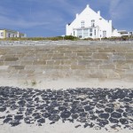
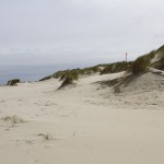
The next day was about as warm as is possible on a North Sea island. We took a bus into the town. After stopping at a take-away for fish in a bread roll, we ventured through the central streets.
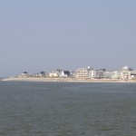
We arrived in Norderney late afternoon on the Friday. Alessandra had unexpectedly arrived the day before and was keen to join us for a weekend on the island.
On the Friday, the tides allowed for a return ferry trip to Spiekeroog. Leaving Neuharlingersiel in the morning, the boat followed a wall of brick, which I’m not sure what to call: maybe a groyne or a boom. This separated a deeper channel from the tidal flats and seemed to lead the whole way across to the island.
